Unley tech innovation maps tree canopy change
Published on 28 March 2022

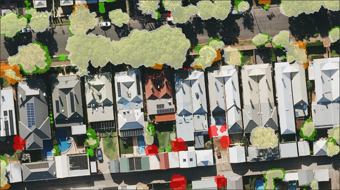
Have you ever wondered exactly how much tree cover you have at your place? We are offering our community an innovative new app which measures and monitors its green canopy, from right across the entire city, down to individual properties – in ground-breaking new technology that could soon be available to every local council concerned about its trees.
Unley has partnered with SA technology start-up Forestree to develop the MyCanopy app (mycanopy.unley.sa.gov.au), which allows users to search Unley residential addresses to visualise and understand how the tree canopy on their property has changed over time.
The work commenced in 2018 when Unley partnered with SA geospatial company Aerometrex to undertake extensive aerial surveys using LiDAR imaging, which were conducted again in 2021.
The resulting images were analysed by Aerometrex data scientists with a custom-designed program able to detect changes to tree canopy, down to a ten-centimetre resolution.
Unley staff were able to accurately map changes to green canopy at a property level over the three-year period and represent the gain or loss of trees and significant foliage as a percentage.
Mayor Michael Hewitson AM said measuring a city’s tree cover was ‘previously a laborious process, which often took months to compile, with a high degree of inaccuracy’. The mayor said that by working collaboratively with these project partners, Unley staff had devised an innovative new way of communicating with its community about achieving objectives in encouraging tree maintenance and retention, and in planting new trees.
‘The simple fact is we are a small city with minimal public land on which Council can plant more trees to address losses. We needed to educate our residents by giving them highly accurate data and urging them to look after the trees that we have, and to consider planting more’.
‘As one of Australia’s first communities to be awarded the title of a Tree City of the World, I am delighted that this Council took a significant step to produce a plan to measure, manage, maintain and reinstate our urban forest when we created Unley’s Tree Strategy’ Mayor Hewitson said.
‘The development of this app has resulted in the creation of an easy-to-use yet powerful tool which shows impacts over time, where our canopy is being threatened or lost because of higher-density development. It also gives us vital information about how we can address this challenge, by working with our community to replace trees wherever we can.’
‘This City of Unley project has the potential to provide real-world benefits to local governments and communities everywhere, with the aim of increasing environmental resilience to the effects of climate change as our seasons become increasingly hotter.’
‘Using this innovative approach, Councils can reduce risks and spending to better manage tree maintenance and to reinstate their green canopy with new tree plantings, by accessing data which enables them to make informed decisions about their urban forests.’
The MyCanopy app is another example of the City of Unley’s leadership in Smart City initiatives, building on existing successful projects include smart-enabled recreational reserves, parking technology and energy-saving lighting. Search for the app at mycanopy.unley.sa.gov.au